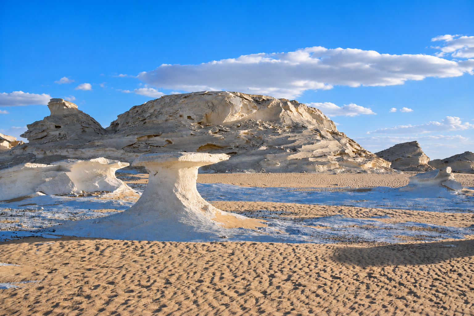
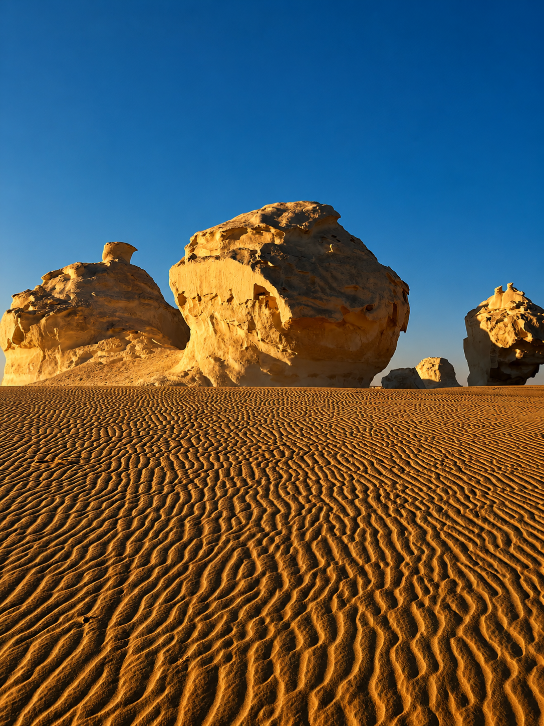
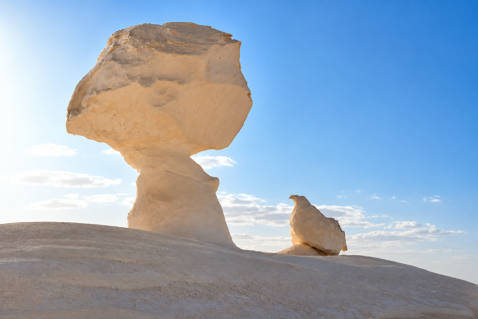
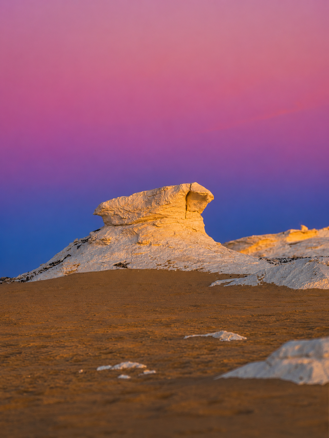
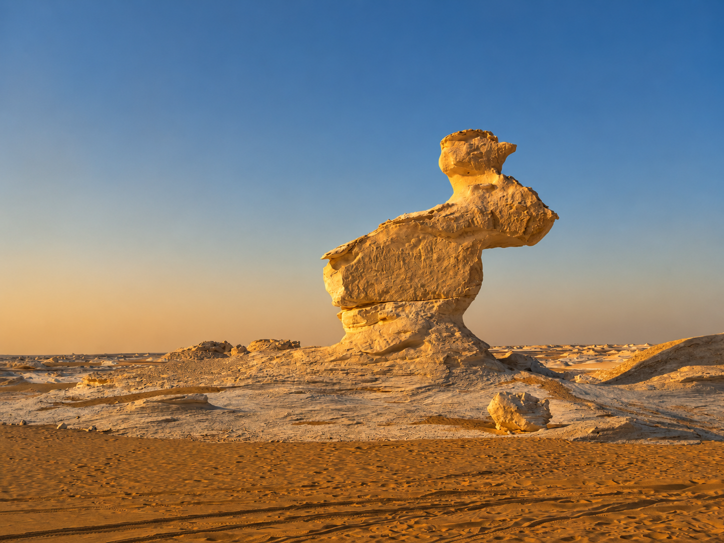
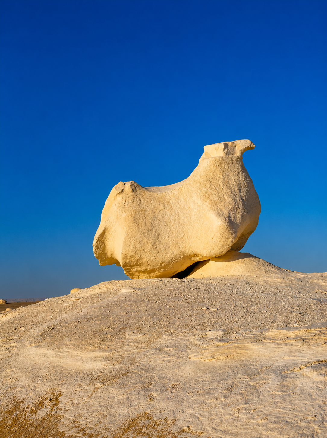
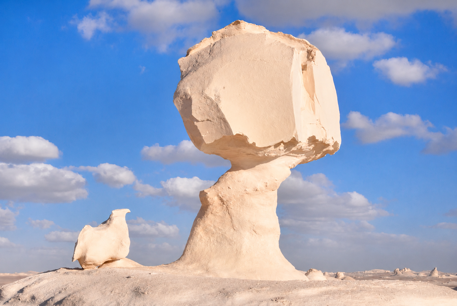
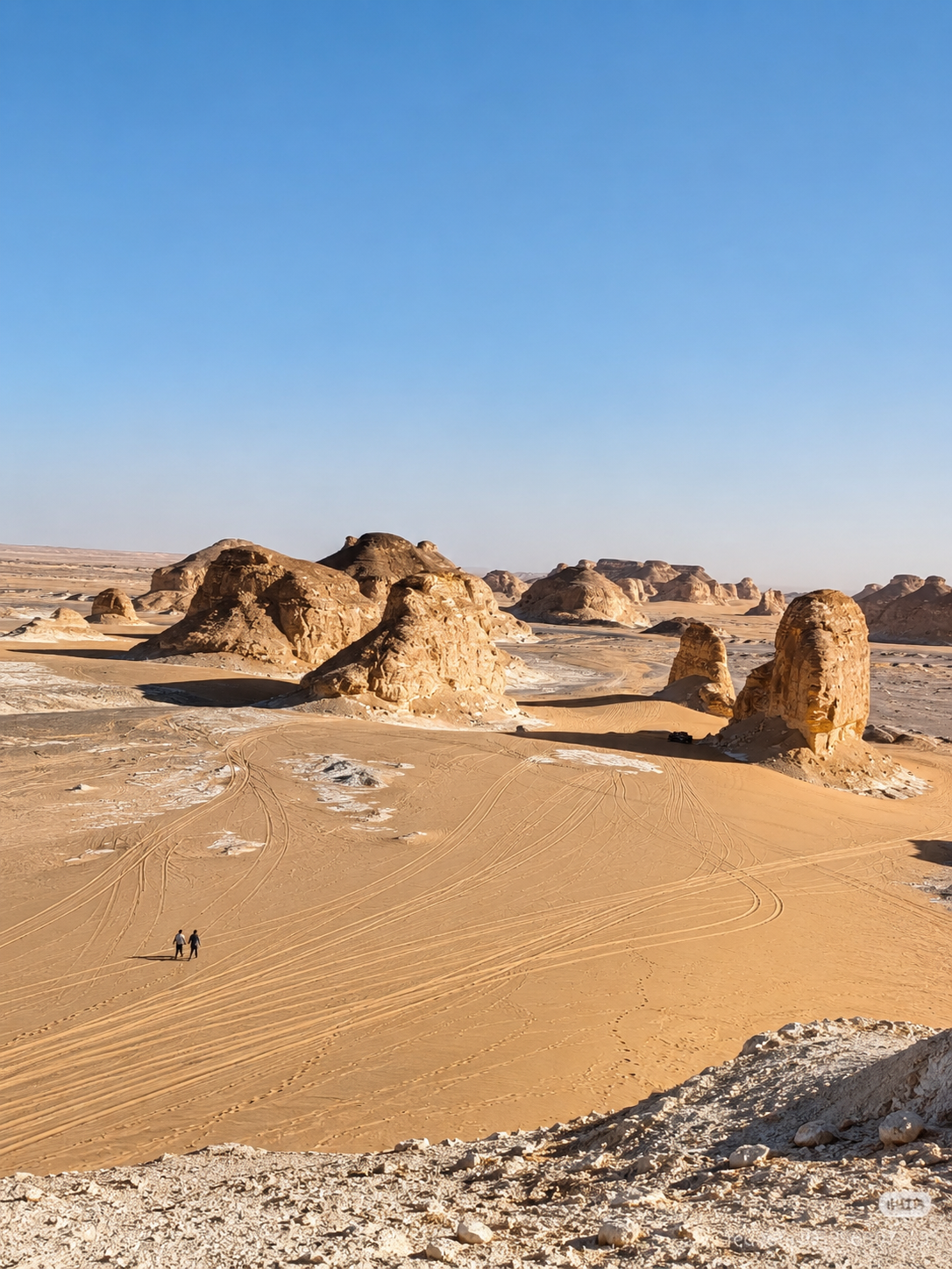
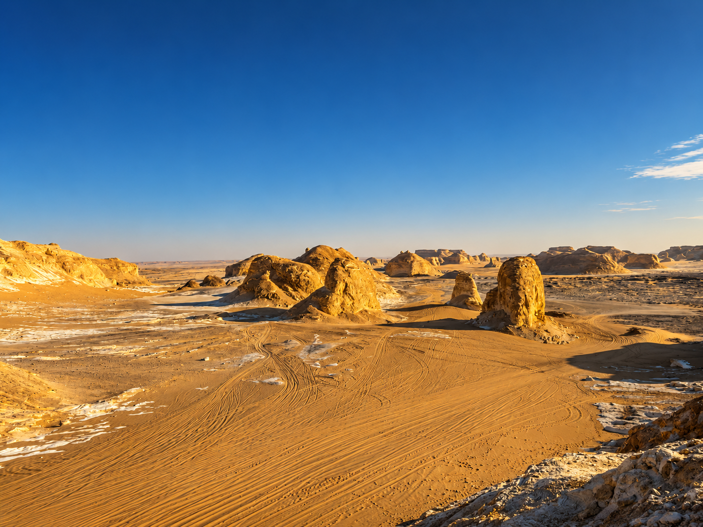
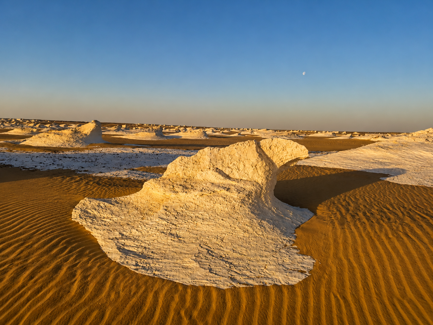
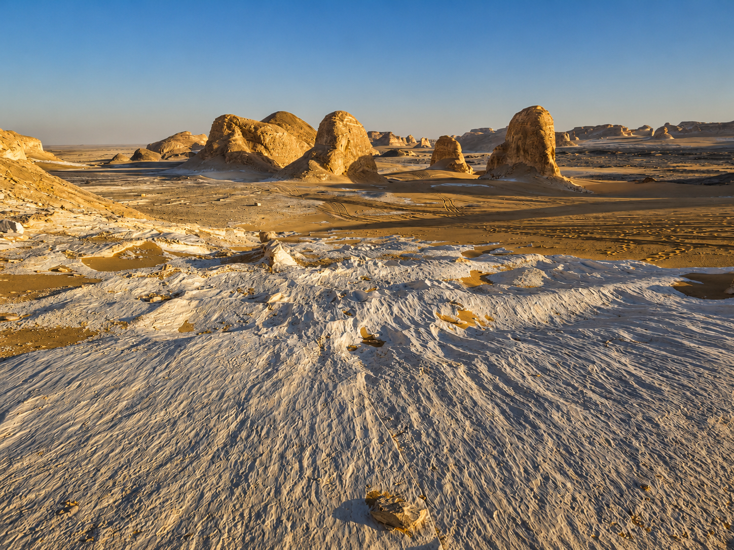
The famous White Desert Egypt formations are mainly chalk and chalky limestone landforms shaped by a combination of ancient marine deposition, karst processes, fractures, weathering and differential erosion by water and wind. Harder rock layers survived while softer material was removed, creating the mushroom rocks, domes, towers, arches and other strange shapes visible today.
That is the short answer.
The full geological story is much more fascinating.
At first glance, Egypt’s White Desert looks like an enormous outdoor sculpture garden.
Brilliant white formations rise from the desert floor. Some resemble mushrooms. Others look like birds, towers, tables, domes or enormous pieces of abstract art.
Yet these shapes were not created by one single process.
And they were certainly not formed overnight.
The White Desert is part of a much older geological story involving ancient seas, carbonate sediments, major climatic changes, karst development, groundwater, tectonic fractures and millions of years of erosion.
Scientific research on the White Desert describes a complex karst landscape developed within carbonate rocks of the Bahariya–Farafra region. Researchers have documented mushroom-shaped hills, isolated rock masses, buttes, natural bridges, domes, collapsed cave features and other karst landforms produced through the interaction of geology, water, wind and long-term erosion.
The Egyptian Environmental Affairs Agency describes the White Desert as an exceptional example of karst phenomena and an open-air location for studying desert environments, geography and fossils. Its official description also notes the brilliant white chalk floor and columns of white chalk shaped by natural erosion.
So when you photograph one of the famous White Desert mushroom rocks, you are looking at much more than an unusual tourist attraction.
You are looking at a surviving fragment of an ancient geological landscape.
For the full destination and travel-planning guide, use White Desert Egypt.
For the protected area itself, continue with Nationalpark Weiße Wüste.

The White Desert is famous primarily for chalk and chalky limestone.
This distinction matters because the landscape is sometimes described online simply as “limestone rocks,” which is not wrong in a broad sense but misses the geological detail.
Scientific work on the Farafra Depression identifies the Khoman Formation as an important part of the geological sequence. It contains extensive chalk deposits, and erosion of those deposits has produced many of the spectacular shapes associated with the White Desert.
More recent stratigraphic work in the Farafra region identifies the White Desert portion of the Khoman sequence as snow-white chalky limestone within a broader Upper Cretaceous–Eocene succession.
Chalk is itself a type of carbonate rock.
It commonly forms from the accumulation of microscopic marine material in ancient seas.
Over geological time, those marine sediments became rock.
Later, after sea levels and landscapes changed, the rocks were exposed and erosion began sculpting them.
This is why the White Desert can feel paradoxical.
You are standing in one of Egypt’s driest regions while the rocks beneath your feet preserve evidence of ancient marine environments.
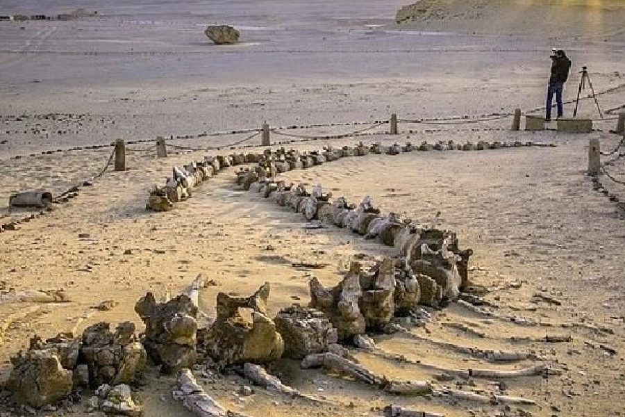
Yes, the geological record of the region is strongly connected to ancient marine environments.
Egypt’s official tourism portal describes the White Desert as originating from an ancient seabed and notes marine fossils preserved within layers of limestone.
Scientific studies of the Farafra Depression also document Upper Cretaceous through Eocene marine sedimentary formations exposed across the region. The Khoman, Tarawan, Esna and Farafra formations preserve different chapters in that long geological history.
This does not mean the modern White Desert was simply a seabed yesterday in geological terms.
It means the rocks you see were originally deposited in marine settings before later uplift, climatic change, erosion and landscape development exposed and reshaped them.
Understanding this ancient marine origin makes the fossils in the White Desert much easier to explain.
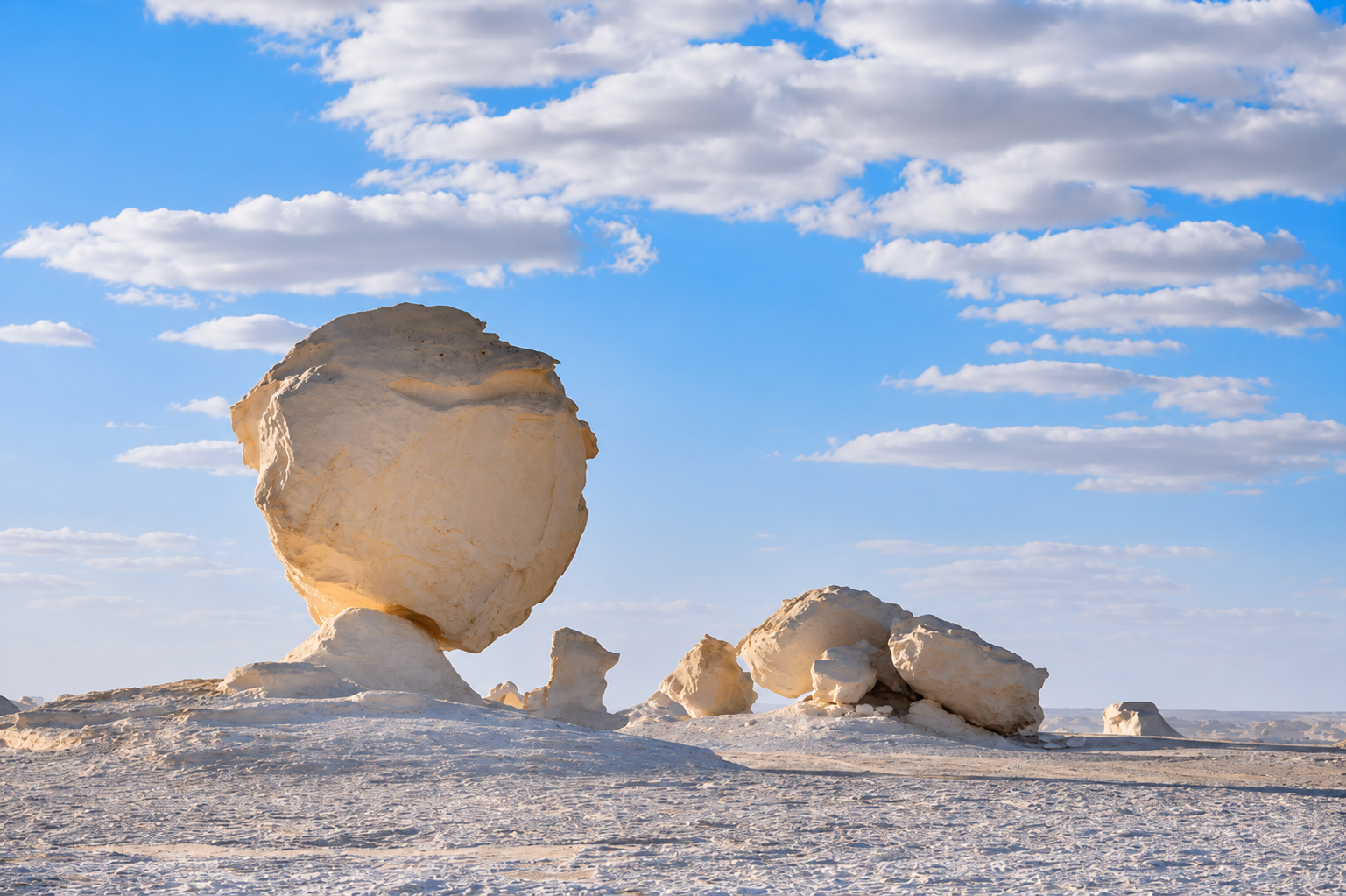
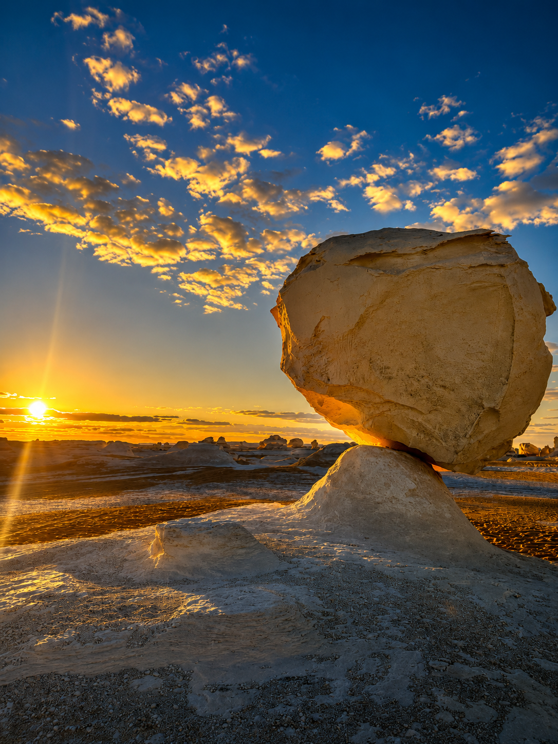
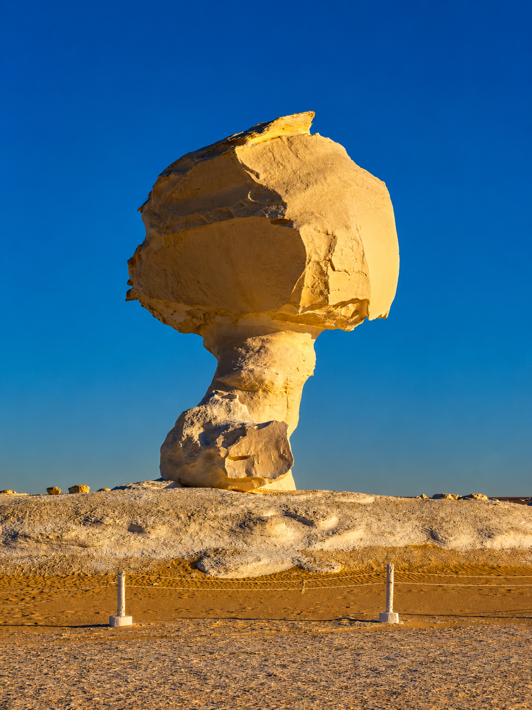
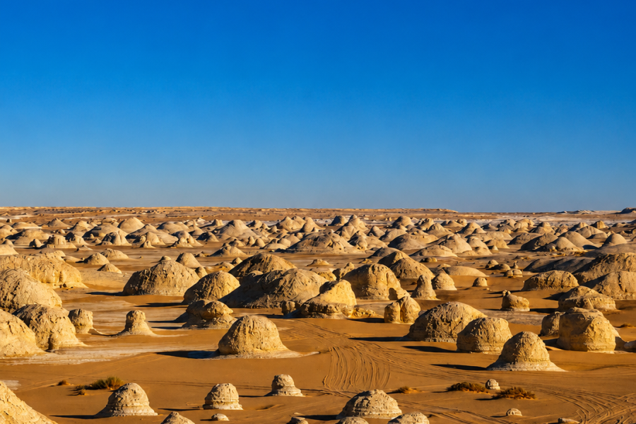
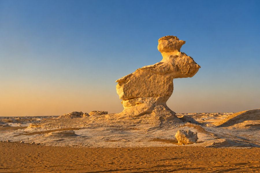
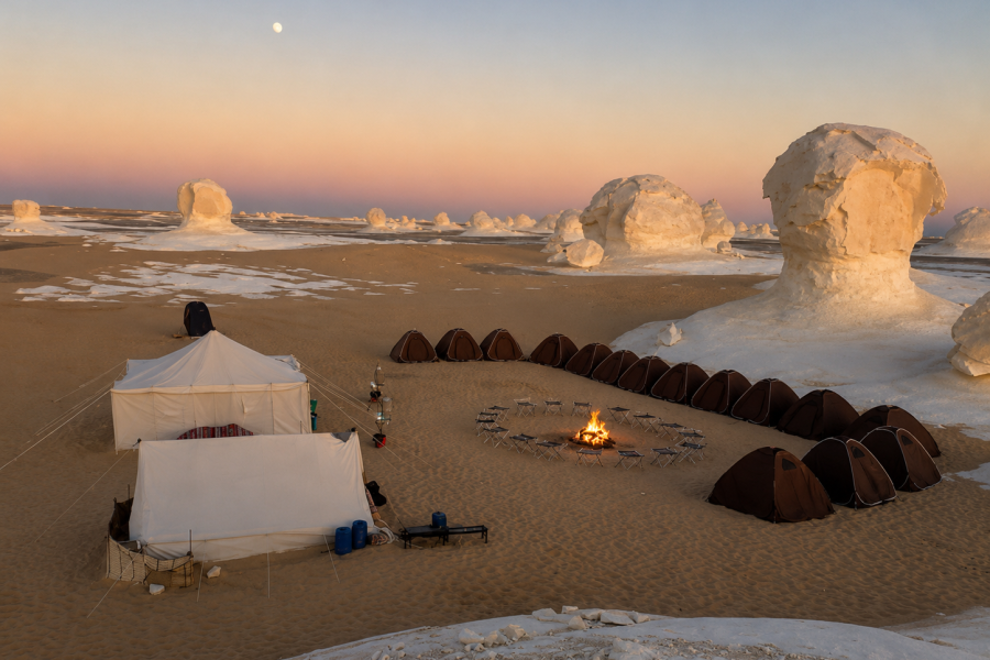
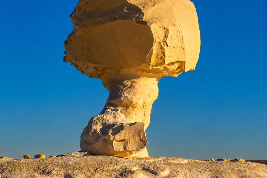
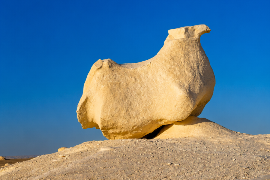
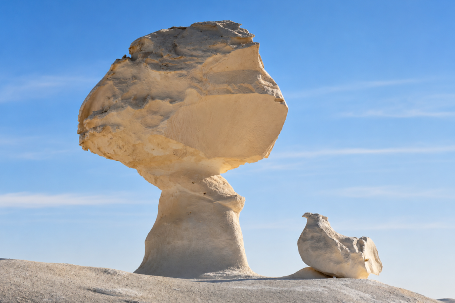
The famous mushroom formations are among the most photographed geological features in Egypt.
They usually have a narrower lower section supporting a wider cap.
The basic principle is differential erosion.
Different parts of the rock resist weathering and erosion at different rates.
Where a more resistant layer or cap protects weaker material underneath, surrounding softer rock can be removed faster than the harder top.
Over time, the lower section becomes narrower while the harder upper section remains broader.
Scientific work on the White Desert specifically describes mushroom-shaped karst hills with irregular necks and caps. Researchers connect these landforms to differences in rock resistance together with the effects of water and wind erosion.
So the common explanation that “the wind created the mushroom rocks” is only part of the story.
Wind matters.
Wind-driven sand can abrade exposed surfaces.
But the final shape also depends on the rock layers themselves, earlier karst development, fractures, water action and the contrast between harder and softer material.
A more accurate explanation is therefore:
geology determines what can survive; erosion determines what remains visible.
Nein.
This is one of the biggest oversimplifications repeated in travel content about the White Desert.
Wind has clearly contributed to shaping the exposed landscape, but scientific research describes the White Desert as a karst system, not simply a set of rocks carved exclusively by blowing sand.
Karst refers to landscapes produced largely through the dissolution and weathering of soluble rocks such as limestone.
In the White Desert region, scientists have documented evidence of solution processes, caves, sinkhole-related features, collapsed karst, natural bridges, fractures and other landforms associated with water and carbonate-rock dissolution.
The region also experienced major climatic changes in the past.
Conditions were not always as dry as the Western Desert is today.
Water could therefore play a much greater role in older stages of landscape development than a modern visitor might assume.
Later desert erosion, wind and sand continued modifying the already complex karst landscape.
That combination explains why the White Desert contains such a wide range of forms.
Karst is a geological landscape created when soluble rocks are altered and dissolved by water.
The world’s most famous karst regions often contain caves, sinkholes, towers and strange limestone hills.
In the White Desert, the process developed under very different climatic phases over geological time.
Researchers describe the wider Bahariya–Farafra region as containing extensive karstified carbonate sequences, with faults, fractures and joints providing pathways along which water could interact with the rock.
This produced features both above and below the ancient ground surface.
Later erosion could remove the material covering caves or underground structures.
What was once partly subterranean could eventually become exposed.
That helps explain some of the White Desert’s apparently impossible landforms.
They are not simply blocks of stone sitting on sand.
Some are remnants of much larger geological systems that erosion has gradually dismantled.
One of the most interesting geological ideas associated with the region is exhumation.
In geology, exhumation does not mean digging up a body.
It refers to older rock surfaces or landforms becoming exposed again after material covering them is removed.
Scientific studies describe exhumed karst across the Bahariya–Farafra terrain.
Older carbonate surfaces were altered, buried or covered and then later exposed by erosion.
This means that some features visible today may preserve geological processes that occurred under very different environmental conditions.
The modern hyper-arid desert is therefore only the latest chapter.


Why Are the White Desert Rocks So Strange?
The remarkable shapes come from the interaction of several factors.
First, different rock layers have different strength and composition.
Second, fractures and joints create natural weaknesses.
Third, water can dissolve and enlarge those weaknesses in carbonate rocks.
Fourth, later weathering and erosion remove exposed material.
Finally, desert wind and blowing sand continue modifying surfaces.
Because all of these variables change from one location to another, the result is not one repeated rock shape.
Instead, the White Desert contains a collection of dramatically different landforms.
Scientists have classified many of these as distinct karst morphologies.
Mushroom-shaped formations are the White Desert’s visual icons.
Their narrow stems and broader caps make them appear unstable, although their geometry reflects differences in rock resistance and erosion.
Some of the best-known formations have become informal landmarks for safari groups.
The shapes also make excellent examples of differential erosion because the principle can be understood simply by looking at them.
Not every White Desert formation has a narrow stem.
Some appear as smooth domes or rounded hills.
Scientific research documents extensive dome karst in the protected area, including chalky limestone forms with solution cavities, windows and collapsed structures.
From a travel perspective, these domes are important because they create a dramatically different landscape from the isolated mushroom formations most frequently shown in promotional photography.
This is one reason a deeper safari gives a much better impression of the geological variety.
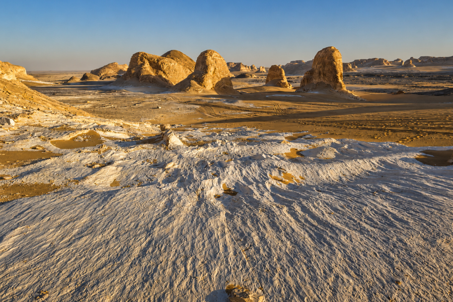
The White Desert also contains isolated steep-sided hills and remnant rock masses.
Scientists describe butte-like formations composed of chalky limestone, with erosion leaving disconnected hills rising above the surrounding surface.
These features demonstrate a basic principle of desert geomorphology.
The present surface is what remains after enormous volumes of surrounding material have already been removed.
The isolated formation is often not something that “grew upward.”
It is something that survived while the surrounding landscape was lowered.
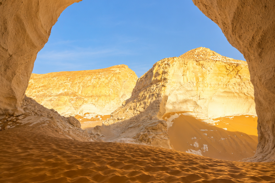
Some White Desert karst forms include natural bridges or arch-like structures.
Researchers have documented bridge karst developed in white chalky limestone, including natural openings several meters across.
These features provide further evidence that dissolution, cavities and structural weaknesses played an important role in the landscape’s evolution.
Arches are also especially vulnerable.
Visitors should never climb fragile formations simply because they look solid.
The White Desert is a protected geological landscape, not an adventure climbing park.
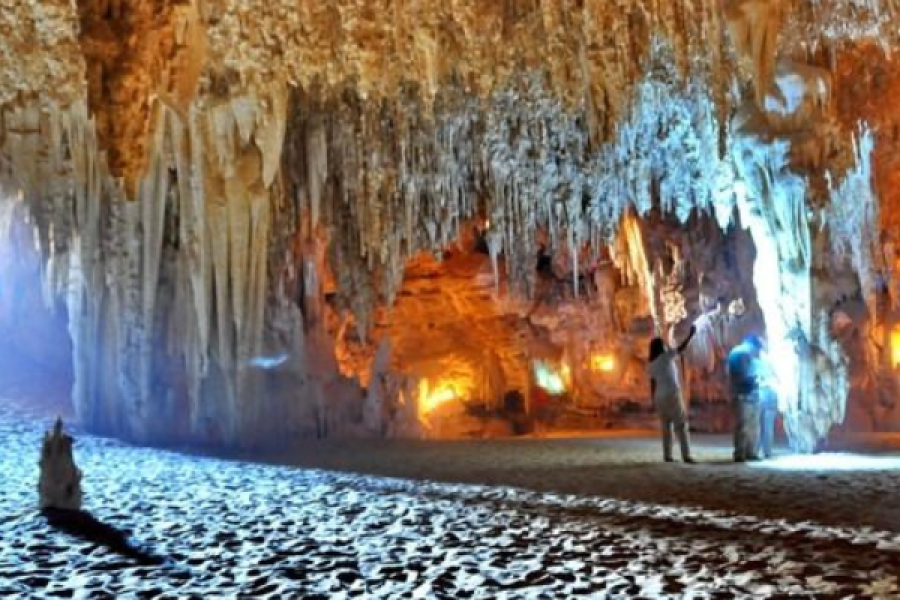
Some of the region’s most scientifically interesting features are remnants of old cave systems.
Research around the White Desert, Crystal Mountain and nearby karst depressions documents collapsed and “unroofed” caves—former underground cavities exposed after their roofs and surrounding material were removed.
This gives the landscape another layer of complexity.
What appears today as an open desert rock feature may have begun as part of a subterranean system.
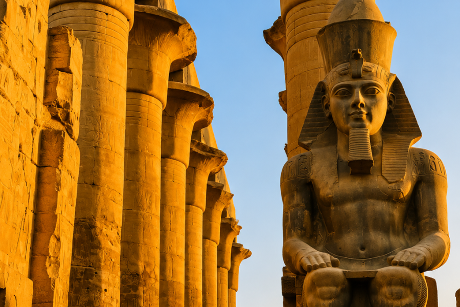
Egypt’s major archaeological sites attract enormous global interest.
That is part of their appeal—but it can also mean:
The desert operates at a different rhythm.
You may still encounter other safari vehicles or camps, especially in popular areas.
Do not expect absolute isolation.
But the sense of open space is very different from Cairo or Luxor.
For travelers who need variety, this can make the overall Egypt holiday much better.
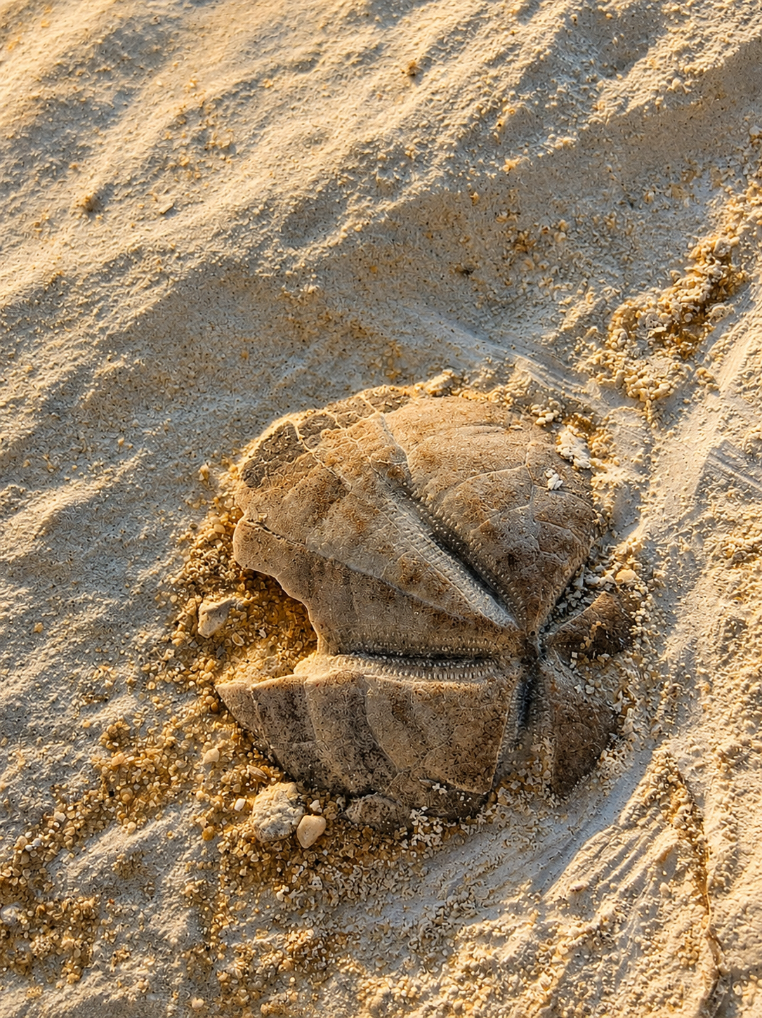
Because the rocks formed in ancient marine environments.
Experience Egypt notes that visitors may encounter marine fossils in limestone layers, including sea urchins, mollusks, crustaceans and coral-related material.
The fossils are not decorative objects placed there for tourists.
They are part of the geological record.
They show that the environmental history of the Western Desert was dramatically different from the landscape we see today.
This is one of the most valuable concepts to explain to children visiting the White Desert.
You can stand in an arid desert, look around at sand and chalk, then find evidence of ancient sea life preserved inside the rock.
For family-focused planning, see Egypt Desert Safari for Families.
You should not.
The White Desert is an officially protected natural area whose geological and fossil heritage is part of the reason it is protected.
EEAA specifically identifies fossils and geological formations among the site’s natural values.
Photograph fossils where you find them.
Leave them in place.
Removing rocks, fossils, crystals or pieces of formations gradually destroys the very landscape people travel to see.
Responsible desert tourism means leaving geological material behind.
There is no useful single age for “the White Desert,” because different rock units and different geological processes belong to different periods.
This is important.
Some travel descriptions try to reduce the whole landscape to one number.
The geology is more complicated.
Scientific studies identify rocks from the Upper Cretaceous, Paleocene and Eocene, while later sediments and landscape processes continued into younger geological periods.
The Khoman chalk associated strongly with the classic white landscape is Upper Cretaceous in age.
Meanwhile, later karstification, tectonic activity, erosion, wetter climatic phases and younger desert deposits continued reshaping the region.
So the rocks can be tens of millions of years old while the visible shape of a particular mushroom formation is the result of much later landscape evolution.
Nein.
The modern Western Desert is extremely arid, but geological and palaeoenvironmental evidence shows that the region experienced very different climates in the past.
A recent study of Farafra palaeolakes describes ancient lake environments within the Western Desert and documents old playa deposits in the White Desert area. Those sediments surround eroded remnants of the White Desert’s Khoman chalk, indicating that water once occupied parts of today’s desert landscape.
Other geological evidence from the Bahariya–Farafra region points toward much wetter periods than today.
This reinforces an important idea:
The White Desert was not created under one unchanging desert climate.
Its modern appearance is the product of many environmental phases.
Travel guides and local safari itineraries sometimes use the informal terms Old White Desert und New White Desert to describe visually different sections of the broader landscape.
These are useful tourism labels rather than simple formal stratigraphic divisions.
The “New White Desert” is often associated in travel photography with spectacular isolated mushroom and pedestal formations.
Other sectors contain broader chalk hills, cliffs, domes and more continuous pale landscapes.
Rather than focusing too heavily on the names, travelers should understand the bigger point:
the White Desert is geologically diverse.
A two- or three-day safari can reveal far more than the single iconic mushroom rock seen on social media.
For trip duration planning, use White Desert Egypt Itinerary.
Nein.
The name can be misleading.
Crystal Mountain, also called Gebel Crystal, is a geological site in the Bahariya–Farafra corridor commonly visited on White Desert safaris.
Modern geological research describes it as a paleokarst feature associated with a former cave system developed in chalky limestone. Calcite crystals occur within parts of the cave-fill sequence.
So it is not a giant solid quartz mountain.
The attraction is more geologically interesting than that simplistic description.
Crystal Mountain preserves evidence of karst, caves, carbonate rocks and mineral crystallization.
It forms part of the wider geological story connecting Bahariya, Farafra and the White Desert.
Most first-time itineraries visit it on the way toward Agabat and White Desert National Park.
For the standard route from Cairo, see White Desert From Cairo.
Agabat provides one of the most dramatic transitions in the wider safari circuit.
The scenery combines golden sand with pale cliffs, rock masses and broad open valleys.
Geologically, it belongs to the same wider Bahariya–Farafra terrain that exposes different carbonate and sedimentary units across the Western Desert.
Visually, it provides an important contrast.
The classic mushroom formations may be the most famous White Desert image, but Agabat often feels larger and more dramatic.
For landscape photographers, that makes it one of the strongest stops on multi-day routes.
The contrast is one of the best reasons to travel through the complete route.
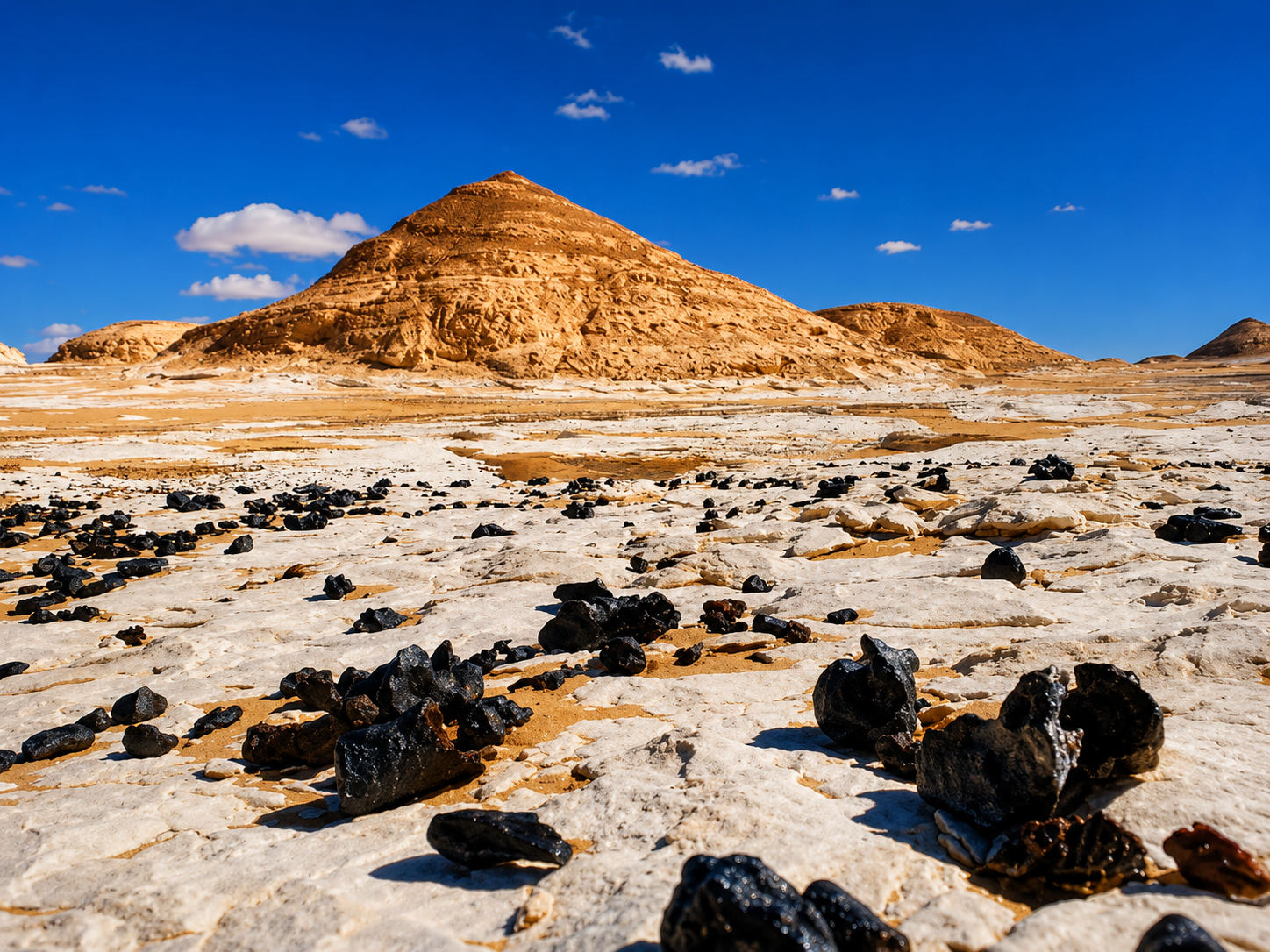
The White Desert is dominated visually by pale chalk and carbonate rocks.
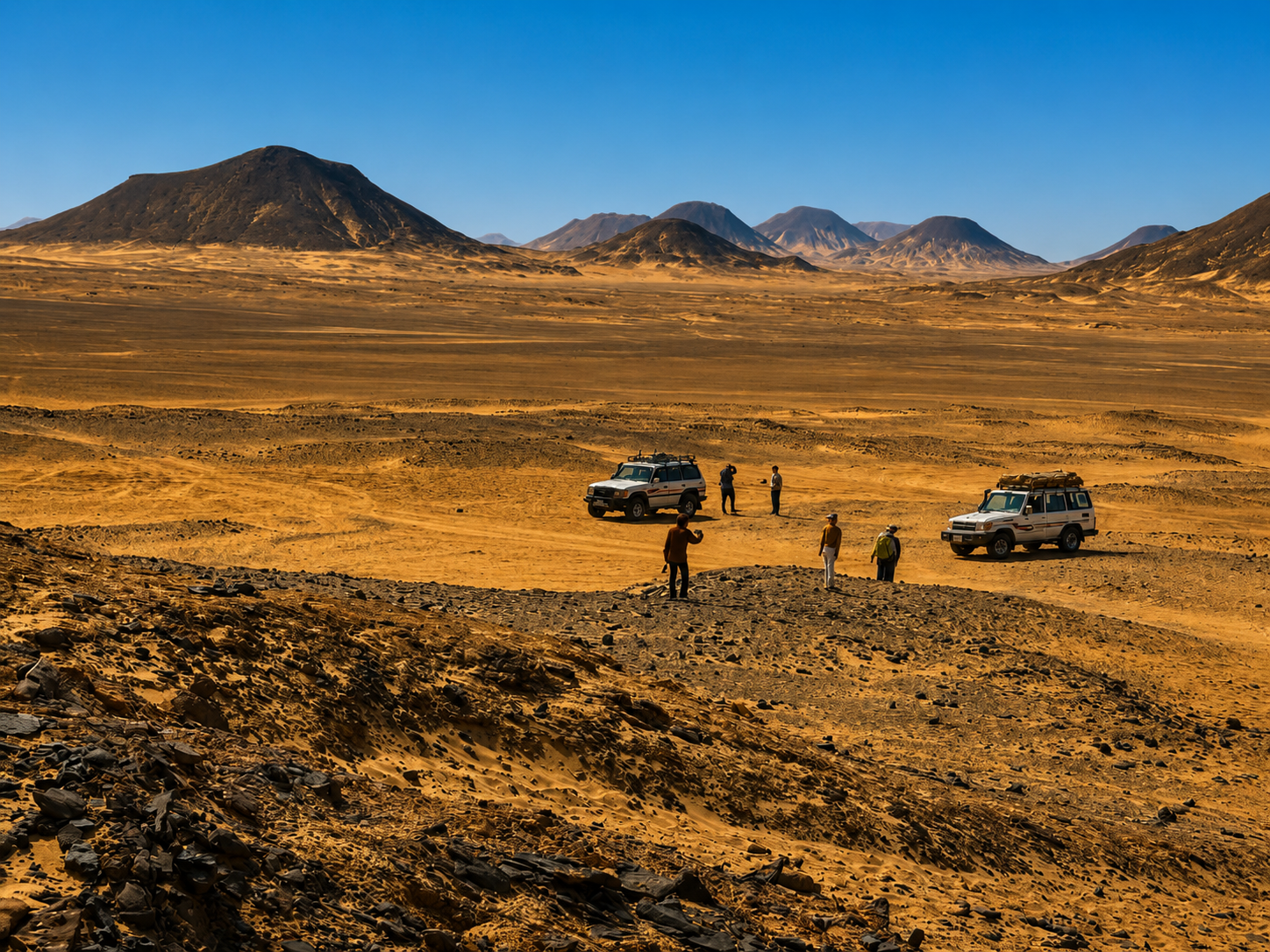
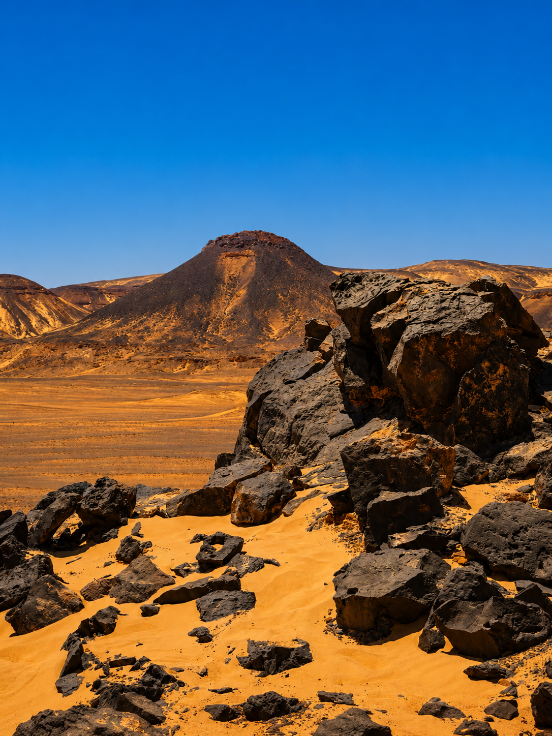
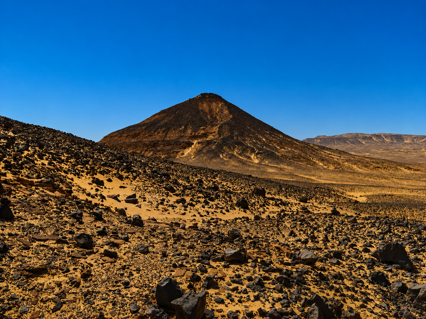
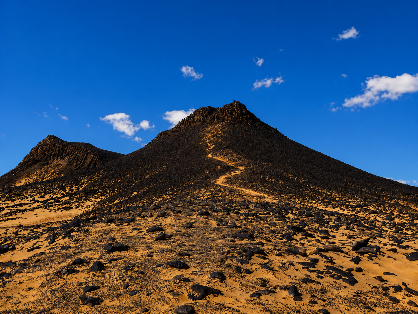
The nearby Black Desert presents dark hills and surfaces, producing a completely different appearance.
From the visitor’s perspective, moving through both landscapes within the same trip demonstrates just how geologically varied Egypt’s Western Desert is.
Rather than asking which one is better, most first-time travelers should see both.
Read White Desert vs Black Desert Egypt for the full comparison.
The geology is one of the main reasons.
Egypt declared the White Desert a natural protectorate in 2002.
EEAA currently lists the protected area as approximately 3,133.5 square kilometers and describes it as a landscape protectorate with exceptional karst, fossils, white limestone and chalk formations, desert ecosystems and prehistoric archaeological material.
This protected status matters to travelers.
It means the formations should not be treated as disposable tourist props.
Camping, vehicle access and visitor behavior should follow current protected-area regulations.
For a deeper explanation of the protected landscape, read White Desert National Park Egypt.
Even when a formation appears strong, climbing is a poor idea.
Many shapes exist precisely because erosion has narrowed, fractured or hollowed sections of rock.
What looks like a large solid structure can contain weathered or weakened material.
There is also the conservation issue.
Repeated climbing by visitors can accelerate damage.
The best rule is simple:
walk around the formations, photograph them and leave them unchanged.
There is no need to stand on top of a mushroom rock to experience it.
Tourism can create environmental pressure if badly managed.
The main risks include vehicle damage, litter, disturbance of geological material, unmanaged camping and direct damage to fragile formations.
But tourism can also create economic value for local communities and increase public interest in protecting the landscape when managed responsibly.
This is why the official management framework combines conservation with controlled visitor access.
The responsibility is shared between authorities, operators, guides and travelers.
Use appropriate routes.
Do not collect geological material.
Remove rubbish.
Avoid damaging formations.
Choose operators that treat the protected area as something to preserve rather than simply consume.
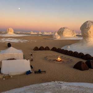
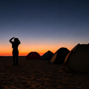
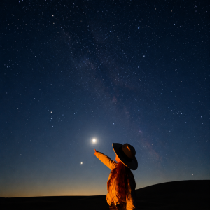
Understanding the landscape can change the way you experience a White Desert camp.
Without geological context, you see unusual white shapes around your tent.
With context, you realize those forms represent remnants of ancient marine sediments, karst systems, climatic changes and enormous periods of erosion.
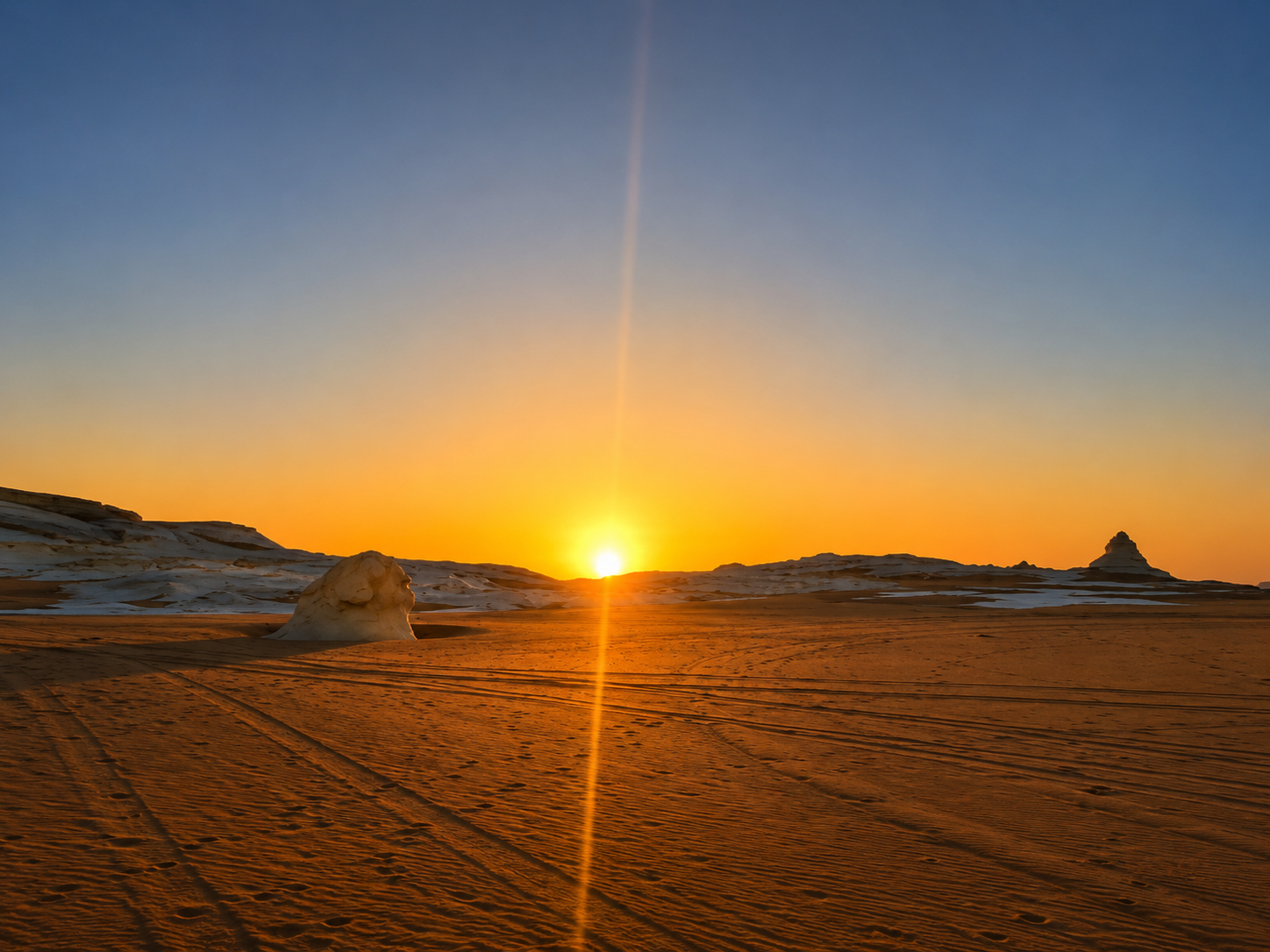
Sunset then becomes more than a beautiful color.
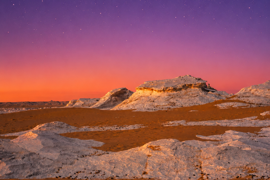
Low-angle light reveals bedding, fractures, cavities and erosion patterns that are difficult to notice at midday.
That makes overnight camping particularly valuable for travelers interested in geology or photography.
For the full camping experience, see White Desert Camping Egypt.
For overall desert travel, October through April is generally the strongest period.
But the time of day matters even more for seeing geological texture.
Midday produces harsh overhead light.
Late afternoon creates long shadows beneath caps and along eroded grooves.
Sunset adds warmer tones.
Sunrise illuminates formations from a completely different direction.
Photographers who genuinely care about shape and texture should spend at least one night.
For seasonal planning, use Best Time to Visit White Desert Egypt.
For photography specifically, use White Desert Egypt Photography Guide.
A one-day trip allows you to photograph the major highlights.
But from a geological perspective, it moves quickly.
A 2-day/1-night tour is the strongest starting point because you see the main Bahariya–White Desert transition while also experiencing the formations at sunset and sunrise.
The recommended first-time route is 1 Night 2 Days White Desert Tour From Cairo.
A 3-day/2-night route gives you much more time inside the Western Desert and reaches a wider range of valleys, dunes and geological landscapes.
For deeper exploration, use 2 Nächte, 3 Tage Camping-Tour durch die Weiße Wüste.
A four-day journey suits photographers, geology enthusiasts and travelers who want the desert itself to become a major part of the Egypt itinerary. See 3 Nights 4 Days White Desert Tour From Cairo.
Yes, particularly if you enjoy unusual landscapes.
The White Desert combines several features rarely encountered together within such an accessible safari route.
You can see marine sedimentary rocks in an extreme desert, mushroom karst, domes, isolated buttes, old cave-related features, natural arches, fossils, dunes and evidence of dramatically different past climates.
The destination therefore works at several levels.
A casual visitor sees beautiful rocks.
A photographer sees shape, light and contrast.
A child sees mushrooms and animals.
A geologist sees stratigraphy, karst, erosion and palaeoenvironmental change.
That ability to reward very different types of visitors is one reason the White Desert is worth the journey from Cairo.
Read Is White Desert Egypt Worth Visiting? for the broader travel decision.
You do not normally pay for each geological formation separately.
The formations are visited as part of a broader safari.
Current tour pricing depends on duration, group size, camping and private/shared arrangements.
For the current cost breakdown and published tour prices, use White Desert Egypt Cost.
The main expense is the journey itself: Cairo transfers, Bahariya logistics, 4×4 transportation, guides, camping and protected-area arrangements.
The Best White Desert Tour for Geology Lovers
For most first-time visitors, two days is enough to understand the broad geological contrast.
The route typically moves from Bahariya toward the Black Desert and then through Crystal Mountain, Agabat and the White Desert.
If geology is one of your main interests, three days is better.
A longer trip allows you to stop without treating every geological feature as a five-minute photograph.
Travelers wanting an even more specialized geological experience can consider the White Desert and Djara Cave Tour From Cairo, which adds a cave environment to the wider Western Desert journey.
The White Desert Egypt formations were created through a long geological sequence rather than one simple erosion process.
Marine sediments accumulated in ancient seas and eventually became chalk and limestone.
Later tectonic movement, fractures, changing climates and groundwater helped develop a complex karst landscape.
Caves, solution features and other carbonate landforms formed during wetter phases.
As the region was uplifted and eroded, older surfaces and underground features were exposed.
Water, weathering, wind and blowing sand continued removing weaker material while harder sections survived.
The result is the landscape visible today:
mushroom rocks, domes, towers, isolated hills, arches, cavities and brilliant white chalk plains.
That geological history explains why White Desert Egypt looks so different from almost every other famous Egyptian destination.
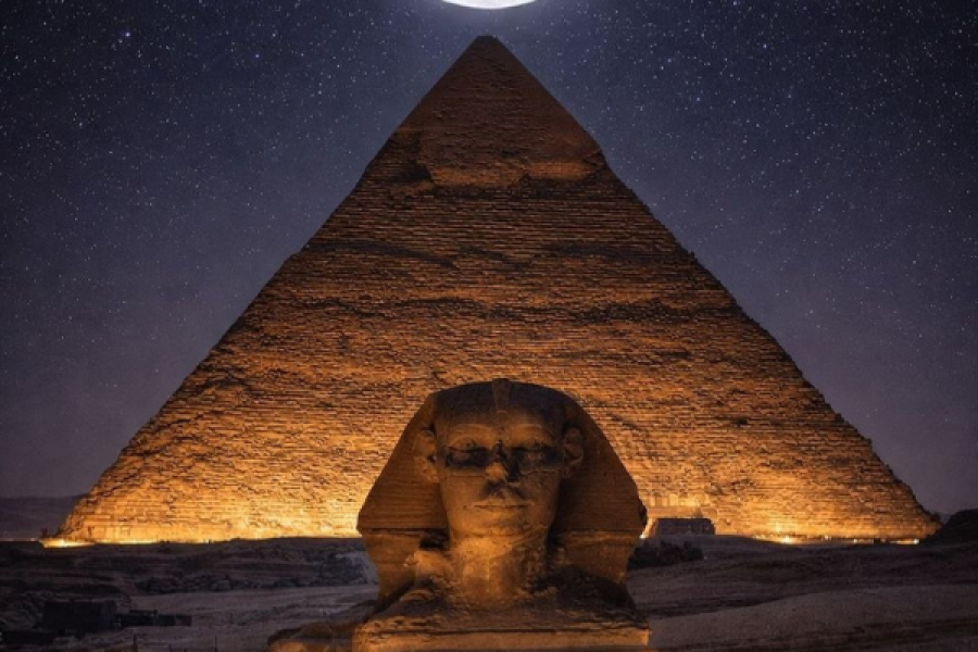
The pyramids tell a story measured in thousands of years.
The White Desert tells a story measured in tens of millions of years.
And once you understand that, the strange white formations stop looking like random rocks.
They become evidence of ancient seas, changing climates and the extraordinary ability of natural processes to reshape the Earth’s surface.
For the complete planning path, continue through White Desert Egypt, Nationalpark Weiße Wüste, White Desert From Cairo, White Desert Camping Egypt und Egypt Desert Safari.